
Snohomish County Block Sources
The strongest public sources describe land, ownership, registration, and civic boundaries. The Snohomish County Online Property Information map, known as SCOPI, lets a reader move from one parcel to the parcels that touch it. The Assessor's property account then provides owner, taxpayer, situs, and legal-description fields. For Everett addresses, the city's neighborhood program adds association boundaries, public meetings, and current civic contacts.
| Source | What It Shows About a Block | Access |
|---|---|---|
| SCOPI parcel map | Parcel shapes, account links, and lots around an address | Free county viewer |
| Assessor account | Owner, taxpayer, situs, and property facts | Public online search |
| Public voter lists | Registered voters and precinct facts allowed by law | Request route; protected data withheld |
| Everett associations | Neighborhood boundary, leaders, and public meetings | Public civic contacts |
| Historical directories | Dated household or street entries where a run survives | Library, society, or archive |
An owner name proves a link to a parcel on the account date. It does not establish who slept there, whether a unit was vacant, or whether relatives and other occupants shared the address. A tax mailing address can differ from the situs address, which is the physical location of the parcel. Keep those fields separate. For condominium land or common elements, SCOPI may show a shared-interest parcel or multiple parcels rather than one simple house lot.
Legal descriptions help when street labels are unclear. A deed may identify a plat, lot, and block instead of relying on the postal address used today. Compare that description with the Assessor parcel number before joining two results. The Auditor's recorded-document search covers most documents recorded since July 1976 online and sends earlier work to microfilm. That source can confirm an ownership transaction, but it still cannot name every person present on the block. For a current neighbor question, the parcel account should remain the first record and the deed should serve as a dated check.
Click Around Snohomish County Neighbors
Search the subject address in SCOPI, open its account summary, and note the parcel number and legal description. Then return to the map and click each lot that shares an edge, plus the parcels across the road. This keeps the work focused on the immediate block. Record the parcel number for each result before relying on the displayed label because subdivisions, condominiums, and assembled lots can produce a “Multiple Parcels (Click for Info)” message.
A blank or odd map space does not always mean that no owner exists. SCOPI can label a common element as a shared-interest parcel or a gap as “Not a Legal Tax Parcel.” Follow associated parcels and compare the legal description. That small map quirk matters most on dense blocks and developments with common land.
Map scale can also change what appears selectable. Zoom close enough to separate lot lines, then confirm the highlighted account rather than copying the nearest house number from the screen. On a corner, include parcels that face the side street only when they share the immediate intersection. Along rural roads, a nearby roof may sit on a large parcel whose legal access comes from another road. Parcel geometry is therefore a better block boundary than visual distance alone. Save the account number and situs field for each click so later comparisons do not drift to a neighboring tax account.
Map Snohomish County Neighbors
The parcel-to-owner flow should stay short: address to mapped parcel, parcel to property account, account to a recorded owner, and owner to a deed only when more proof is needed. A parcel is a mapped unit of land used for tax and record purposes. It may not match a fence, postal stop, or apartment unit. The property account is useful for current context, while a recorded deed documents a transaction on a certain date.
- Locate the address in SCOPI and save its parcel ID, situs address, and map position.
- Click the adjacent and facing parcels, opening the account summary for each one.
- Compare owner and mailing fields without assuming the tax recipient occupies the site.
- Use the Auditor's recorded-document index only when a deed or legal-description link needs confirmation.
Stop at the block edge when the aim is to identify nearby parcels. A search along an entire road belongs in the Snohomish County street directory, which follows address-keyed records beyond the immediate radius. That division avoids turning a neighbor check into an unnecessary survey of a full named street.
Unincorporated Snohomish Block Records
The PDS Map Portal guide covers unincorporated Snohomish County. Its Find an Address panel accepts street, city, and ZIP, while other modes search parcel, permit number or type, and township, range, and section. The Run Property Report feature can add permit and planning context to a block. Incorporated cities keep their own permit systems, so a county map result does not make PDS the custodian for every address.
Annexation can change which city provides service or keeps a later permit without erasing older county deeds. Check the current municipal boundary, then use the office responsible for the date and record type. Everett's annexation history map is especially helpful when an older address appears county-linked in one source and city-linked in another.
This split is common across a county that ranges from Everett and the Puget Sound lowlands to rural river valleys and mountain communities. An address can carry a familiar city name for mail while remaining outside incorporated limits for permits and local services. Conversely, a parcel brought into a city may retain older county permit references. When the custodian is uncertain, use the county annexation parcel search and the city's own boundary material before requesting a file. The record date matters as much as the present outline.
Note: PDS is the unincorporated permit route; city addresses should be checked with the city custodian shown by the current boundary.
Snohomish County Neighbor Associations
Everett recognizes 19 neighborhood areas and a Council of Neighborhoods. The Everett neighborhood associations page provides boundaries and association names, while the city's 2025 neighborhood-leaders document identifies meeting and contact status. These are civic tools. They do not disclose member lists or certify who lives at a house.
The association page is captured from the official city source.
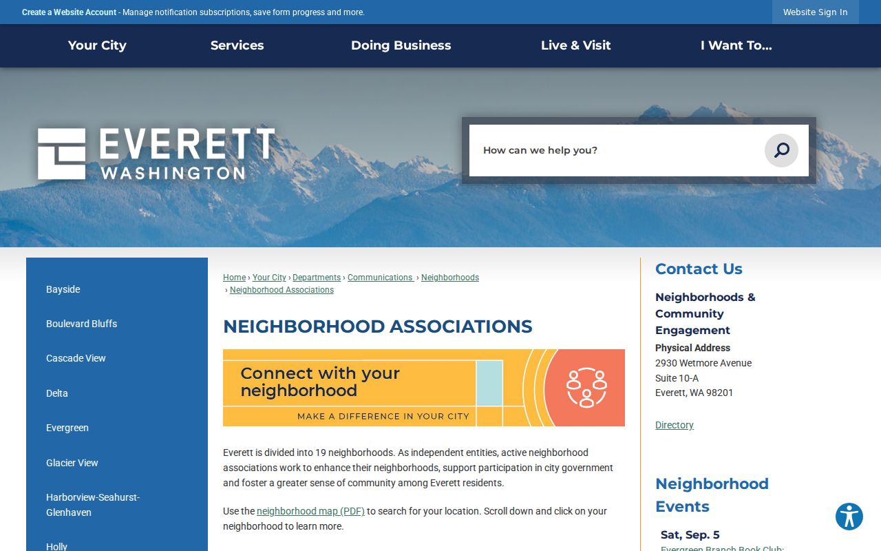
The city list helps a resident identify the right civic area and public contact without treating an association as a directory of private households.
Everett Neighborhoods
Use the city map and association list for boundaries, public meetings, and leader contacts.
Council of Neighborhoods
Use the city program for community-wide civic coordination and current meeting information.
Other County Communities
Check the relevant city, town, or unincorporated-area organization; no countywide private member roster was found.
Snohomish County Neighbor Voter Records
Washington law makes current voter lists, poll books, and precinct lists public subject to RCW 29A.08.710 and protected-record rules. A statewide voter-file request goes to the Secretary of State under RCW 29A.08.105. Full dates of birth, Social Security numbers, driver-license identifiers, signatures, and protected physical addresses are not ordinary public fields. VoteWA itself is a personal portal requiring the voter's matching first name, last name, and date of birth.
A voter list identifies registered voters, not every neighbor. It omits people who are not registered and may use a substitute address for a protected voter. It also does not show ballot choices. Use a lawful public-list request only for the specific civic purpose allowed, and never fill gaps by guessing who shares a household.
Snohomish Elections is the local point for registration help and can redirect statewide file requests. Its office is at 3000 Rockefeller Avenue in Everett, with public hours generally Monday through Friday from 9 a.m. to 5 p.m., subject to election and holiday changes. Historical poll books and registration registers require an Archives catalog search because the research did not identify a complete local year run. Keep any historical entry tied to its election date and precinct, since later annexation or redistricting can move the same address into a different civic geography.
Official Snohomish Neighbor Evidence
Official records and commercial neighbor tools serve different roles. County and city sources disclose a limited filed fact with a named custodian and correction route. Commercial tools may merge old phone, address, or marketing data and can lag behind moves and name changes. Their result should never override the parcel account, court, voter custodian, or association's own public notice.
| Source type | Best use | Main limit |
|---|---|---|
| County parcel and account | Map lots and identify recorded owners | Does not list all occupants |
| Public voter record | Confirm allowed registration and precinct facts | Protected and unregistered people are absent |
| Neighborhood association | Find civic boundaries, contacts, and meetings | Not a household roster |
| Commercial category | Possible lead that needs official confirmation | May be stale, merged, or incomplete |
Protect Snohomish County Neighbors
Property accounts do not reveal every renter, child, guest, or household member. Utility and delivery accounts remain private. Washington's Address Confidentiality Program under RCW 40.24 supplies eligible survivors and protected people with a substitute address; their actual address, city, county, and precinct are confidential in protected voter and marriage records. A missing or substitute address is a safety boundary, not a puzzle to defeat.
Use a neighbor lookup for ordinary civic contact, property curiosity, or personal safety awareness. Contact an association through its published leader or attend a public meeting rather than trying to compile private names. If an official parcel field is wrong, report the exact parcel and account to the Assessor. If a civic contact is stale, ask the city program to update its public page.
Lawful use. Respect every neighbor's privacy. Never use public names, parcel links, voter facts, or association contacts to watch, harass, intimidate, or harm a person.